Utility mapping is an essential process for developers, engineers, and construction professionals who are involved in planning and executing projects that require excavation or ground disturbance. Understanding the location of underground utilities such as water pipes, gas lines, electrical cables, and telecommunications infrastructure is crucial to ensure safety, compliance, and efficiency. This comprehensive guide delves into the intricacies of utility mapping, exploring its importance, methodologies, technologies, and best practices.
The Importance of Utility Mapping
Ensuring Safety
One of the primary reasons for utility mapping is to ensure the safety of workers and the public. Accidental strikes on underground utilities can lead to catastrophic consequences, including gas leaks, electrical hazards, and water main breaks. By accurately mapping these utilities, developers can significantly reduce the risk of accidents on site.
Compliance with Regulations
Regulatory bodies often mandate utility mapping as part of the planning and construction process. Compliance with these regulations is not only a legal requirement but also a responsibility to the community and environment. Accurate mapping helps in adhering to these standards, avoiding potential fines and project delays.
Optimising Project Efficiency
Utility mapping aids in optimising project timelines and budgets. By knowing the exact locations of utilities, developers can plan their work more effectively, avoiding unnecessary disruptions and rework. This foresight can lead to significant cost savings and a smoother project execution.
Methods of Utility Mapping
Traditional Surveying Techniques
Traditional surveying techniques have long been employed in utility mapping. These methods include manual probing and the use of maps and records to identify utility locations. While these techniques can be effective, they often lack precision and can be time-consuming.
Geophysical Surveying Methods
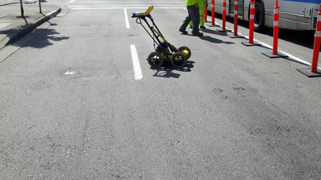
Geophysical surveying methods, such as ground-penetrating radar (GPR) and electromagnetic location, offer more advanced solutions for utility mapping. These technologies provide a non-invasive means to detect and map utilities with greater accuracy. GPR, for instance, uses radar pulses to image the subsurface, while electromagnetic methods detect metallic utilities through their magnetic fields.
Advanced Digital Mapping Technologies
In recent years, digital mapping technologies have revolutionised utility mapping. Geographic Information Systems (GIS) and Building Information Modelling (BIM) are increasingly used to create detailed, interactive maps of utility networks. These technologies allow for real-time updates and integration with other project management tools, enhancing collaboration and decision-making.

Technologies in Utility Mapping
Ground-Penetrating Radar (GPR)
Ground-penetrating radar is a widely used technology in utility mapping due to its ability to provide detailed images of the subsurface. GPR systems emit radar waves into the ground and record the reflected signals, which are then analysed to determine the presence and depth of utilities. This technology is particularly useful for detecting non-metallic utilities, such as plastic pipes.
Electromagnetic Location
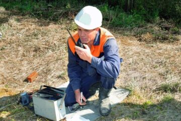
Electromagnetic location involves the use of specialised equipment to detect the magnetic fields generated by metallic utilities. This method is effective for locating buried cables and pipes, offering a reliable means of mapping utilities with minimal disruption to the site. The equipment can also be used to trace the path of utilities over long distances.
Utility Mapping Software
Utility mapping software plays a crucial role in modern utility mapping projects. These software solutions offer a range of features, including data collection, analysis, and visualisation. They enable developers to create detailed maps, manage utility data, and integrate with other project management tools. Popular software options include GIS platforms and BIM applications, which provide comprehensive mapping and modelling capabilities.
Best Practices for Utility Mapping
Conducting Thorough Research
Before commencing any utility mapping project, it is essential to conduct thorough research. This involves reviewing existing utility records, maps, and plans to gain an understanding of the site’s utility infrastructure. Engaging with utility companies and local authorities can also provide valuable insights and data.
Utilising Multiple Mapping Techniques
Relying on a single mapping technique can lead to incomplete or inaccurate results. By utilising a combination of methods, such as GPR, electromagnetic location, and traditional surveying, developers can achieve a more comprehensive understanding of the utility landscape. This multi-faceted approach enhances accuracy and reduces the likelihood of errors.
Regularly Updating Utility Maps
Utility maps should be regularly updated to reflect changes in the utility network. This is particularly important in urban areas where infrastructure is continually evolving. Regular updates ensure that maps remain accurate and reliable, supporting ongoing and future development projects. Click here to get more why subsurface utility locating is essential for construction safety.
Challenges in Utility Mapping
Data Accuracy and Reliability
One of the significant challenges in utility mapping is ensuring data accuracy and reliability. Inaccurate data can lead to costly mistakes and safety hazards. To mitigate this risk, developers must employ rigorous data validation processes and utilise high-quality mapping technologies.
Access to Utility Records
Accessing accurate and up-to-date utility records can be challenging, particularly in areas with complex utility networks. Developers often need to liaise with multiple utility companies and local authorities to obtain the necessary information. Building strong relationships with these stakeholders can facilitate access to critical data.

Managing Subsurface Conditions
Subsurface conditions can vary significantly, affecting the accuracy and effectiveness of utility mapping efforts. Factors such as soil type, moisture content, and the presence of other underground structures can impact the performance of mapping technologies. Developers must consider these conditions when planning and executing utility mapping projects.
Conclusion
Utility mapping is a vital component of the development process, offering numerous benefits in terms of safety, compliance, and efficiency. By understanding the importance of utility mapping, employing a range of mapping methods and technologies, and adhering to best practices, developers can ensure successful project outcomes. Despite the challenges involved, the advancements in mapping technologies and methodologies continue to enhance the accuracy and reliability of utility mapping, paving the way for safer and more efficient development projects.

0 Comments